
Gilgit’s Hidden Valleys: Untouched Beauty and Serenity
Western Boundaries of CKNP
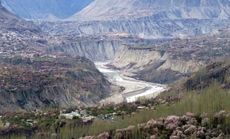
Gilgit is the administrative and capital city of Gilgit-Baltistan Province. The Karakorum Highway runs just outside of the Park’s western boundary. Gilgit, strategically located within the Karakorum’s most important region, has been the trade center for the area for centuries. Gilgit is a junction between Central Asia and Cina and has been an important city along the Silk Route for centuries, helping religions spread trans boundaries.
Waters from the Hunza, Ghizer, and Indus rivers and their tributaries irrigate this area. Gilgit is a predominantly Shina-speaking area, but English and Urdu are also widely spoken. From Gilgit, it is possible to explore some of the Park’s beautiful but less touristy valleys.
The valleys are typically green and covered with trees.
Gilgit is a great starting point for some fascinating Rakaposhi trekking. It is possible to get to two or three Rakaposhi bases from here.
Main valleys of the Park near Gilgit:
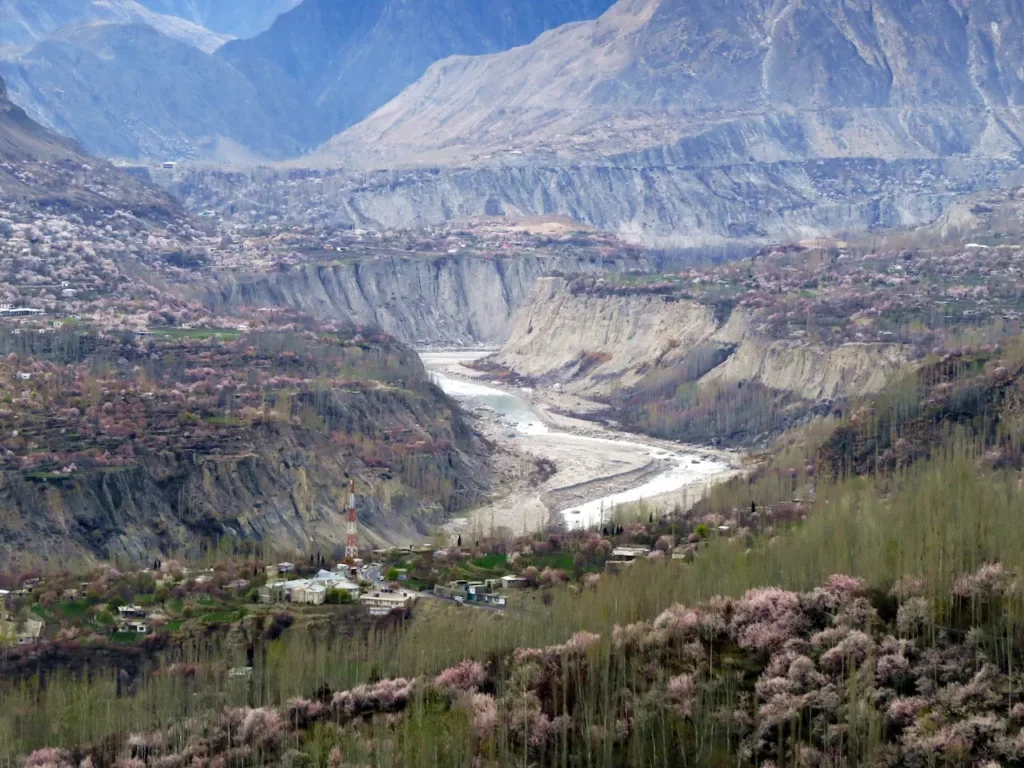
Bagrote Valley
Bagrote Valley starts at Jalalabad a few kilometers south-east of Gilgit.
Follow the north direction. By jeep, you can reach Sat via the Bagrote Valley road. The valley is now divided into two valleys. The Hinarche Glacier leads to Rakaposhi Base Camp. (trek 14). Rakan Gal is the only way to reach the Haramosh Valley on the right (trek 14).
Haramosh Valley
The Haramosh Valley is located between Gilgit Skardu. The Haramosh Valley is open and green, with a lot of trees. It is divided into sub-valleys a few kilometers from Dassu (the main village of the valley). You can reach Bragote Valley from the northwest direction by Rakhan Gal. You can easily reach Kutwal Lake by going north-east, through the Baskai glacier (trek 11). You can reach the Laila Base Camp and Haramosh Glacier by going east through the Mani Glacier and Haramosh Pass (trek 10).
Danyore Valley
The valley’s southern face, Rakaposhi South Face, is at the end of the valley and faces Gilgit.
Jaglot Valley
The Jaglot Valley is located on the western side. The valley is similar to other valleys in the western park. It is green with pastures. The Jaglot Glacier is located in the upper valley and can be followed to reach the Rakaposhi Base Camp (trek 15). In Rahimabad you can reach the Karakorum Highway by going south, a few kilometers below Jaglot village. (Trek 42). You can reach Nilt, in Nagar Valley, by hiking in the north direction.
Explore The Natural Beauty of Gilgit Baltistan, Pakistan
.Introduction: Nestled in the northernmost part of Pakistan, Gilgit Baltistan offers a treasure trove for travelers who are looking to experience nature in its purest state. This region is a haven for nature lovers, explorers, and those who love the majestic mountains and serene lakes. This blog will explore the natural beauty and captivating experiences of Gilgit Baltistan.
-
Majestic Mountain Ranges:
Gilgit Baltistan has some of the highest mountain ranges in the world, such as the Himalayas and Hindu Kush. The peaks of Nanga Parbat, K2, and other colossal peaks like these create an eerie backdrop that attracts mountaineers and hikers from all over the world. There are many trekking routes in the region, which allow adventurers to immerse themselves into the beauty of these snowcapped peaks.
-
Crystal Clear Lakes:
Gilgit Baltistan is home to several lakes that reflect the surrounding mountains, creating an enchanting sight. Attabad Lake is one of the most beautiful lakes in Gilgit Baltistan. It was formed by a huge landslide. Satpara Lake and Upper Kachura Lake are just a few of the pristine lakes that offer peace and tranquility amid breathtaking mountain scenery.
-
Glacial Wonders:
Glaciers are a beautiful addition to the natural beauty of this region. The Baltoro Glacier is an impressive sight that stretches over 62 km and provides access to some of the highest peaks in the world. Biafo, Hispar, and other glaciers also attract adventurers for exciting glacier treks.
-
Rich Biodiversity
The diverse topography of Gilgit Baltistan and its climate supports a wide variety of flora. This region is home to rare and endangered species like the Marco Polo sheep, Himalayan Ibex, and snow leopard. The Deosai National Park is the second-highest plateau in the entire world. It offers a unique opportunity to see this wildlife in its natural habitat.
-
Cultural Heritage
Gilgit Baltistan, besides its natural beauty, is a melting pot of cultures and traditions. The region is home to diverse ethnic communities, including Shinas, Baltis, and Burushaskis. The vibrant culture is reflected in their warm hospitality, colorful festivals, traditional music, and delicious cuisine.
-
Majestic Mountains & Peaks
Gilgit-Baltistan has some of the highest peaks in the world, including K2, which is the second-highest peak on Earth. Every angle of the region reveals breathtaking beauty. The grandeur of these mountains will impress even the most adventurous mountaineer.
-
Glacial Marvels
Gilgit-Baltistan’s Karakoram range and Himalayan range are adorned by numerous glaciers. Baltoro Glaciers, Biafo Glaciers, and Hispar Glaciers are among the longest glaciers outside of the polar region. These giants of ice reflect a shimmering, blue color creating an eerie atmosphere. This is a once-in-a-lifetime experience to trek along the glaciers and see nature’s masterpiece.
-
Pristine lakes
Gilgit-Baltistan has serene lakes which offer peace and tranquility amid nature’s splendor. Lake Saif-ul-Malook is known for its turquoise water and ethereal beauty. Attabad Lake was also created by a natural catastrophe. It features turquoise waters, surrounded by mountains and a beautiful backdrop. -
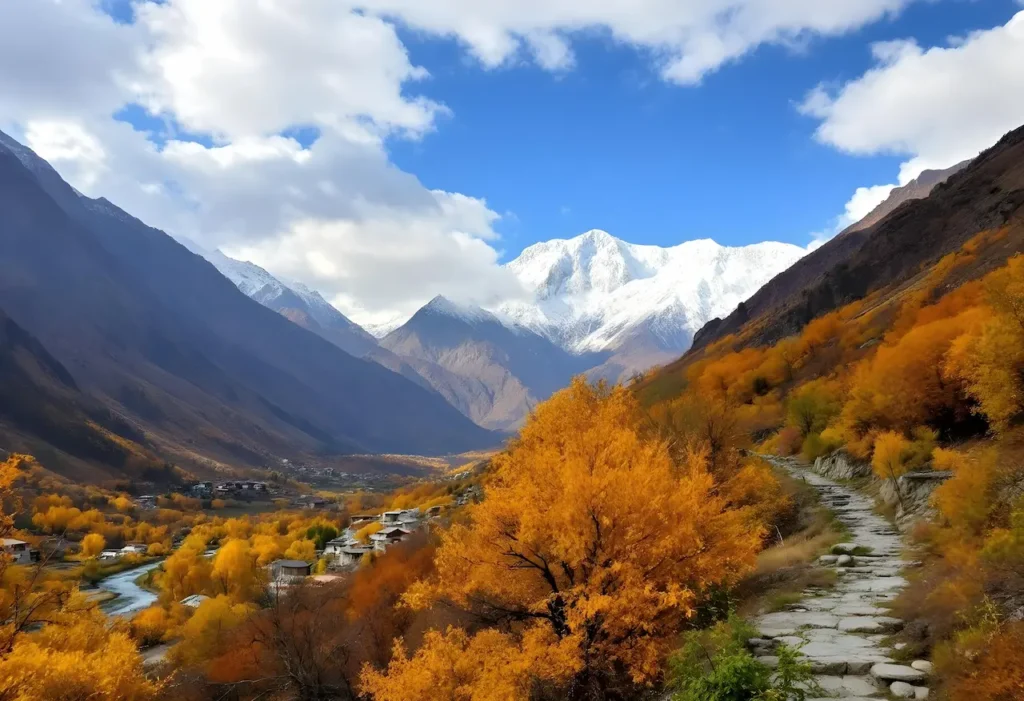
Blossoming Valleys
Several valleys in the region display nature’s artistic talent. Hunza Valley is known as the “Shangri La of the Himalayas” and attracts tourists with its flower-filled landscapes, terraced fields, and traditional stone house. The Naltar Valley, with its beautiful meadows, skiing, and other activities, is a wonderful place for nature lovers. -
Rich Biodiversity
Gilgit-Baltistan, beyond its stunning landscapes, is home to a diverse range of floras and fauna. Numerous rare and endangered species live in the region, such as the Himalayan brown and snow leopard. The region’s wildlife sanctuaries and national parks offer a unique opportunity to observe the biodiversity of this remote, pristine environment.
-
Enchanting Waterfalls
-
Gilgit-Baltistan also has enchanting waterfalls, which add a magical touch to the landscape. Nanga Parbat and Khunjerab’s cascades are breathtaking. The lush greenery surrounding these waterfalls creates a cool and refreshing atmosphere.
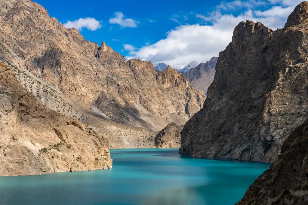
Attabad Lake in Hunza Valley, Gilgit-Baltistan, Pakistan
Untouched Beauty: My unforgettable Pakistan trip
I was eager to see this beautiful country with a landscape that is rarely visited and a lack of tourists. I’d heard amazing stories about Pakistan from other travelers, and I was eager to visit the country myself.
People who have never been to Pakistan may think it’s dangerous based on what they hear in our Western media. I wanted to see the incredible hospitality of Pakistan and its stunning landscapes for myself and form my own opinion about this country. I went with an open-minded attitude and a thirst for adventure.
Media Myths and Amazing Reality
Before I left for Pakistan, my response was mixed. I received everything from ‘Wow! That should be an amazing adventure to “Be very cautious”. People were worried about my safety because of all the bad press Pakistan has had in the past. It’s a good thing I didn’t allow this negativity to affect me because this trip was the best of my life. This is a stunning and misunderstood location that I can’t recommend enough.
Pakistan has made great strides since the border issues it had with Afghanistan ten years ago. During my two-week stay in Pakistan, I never felt threatened or unsafe. Everywhere I went I was welcomed with a smile. I was treated with the most gracious hospitality of any country that I have ever visited!
Arriving at Islamabad
My trip began with a direct flight from London Gatwick, which took 7 hours and 30 minutes. My first night was spent in Islamabad. It was an experience that I had not expected from a capital city of South Asia. In 1960, the city was built to become Pakistan’s new capital. The city is very clean, with well-manicured gardens. It was also not as busy as other capitals in the region.
Flying to Gilgit
The stunning snow-capped mountains of Northern Pakistan were visible as the propeller-driven flight rose out of Islamabad. Sit on the right side of the plane if you have the chance to fly on this flight. You will get the best view of the mountains as you travel north to Gilgit.
The scenery was breathtaking. We also saw the Nanga Parbat as we got closer. It is the ninth-highest mountain in the world and is known as the “King of the Mountains”.
It is also a unique flight because it flies through the mountains and lands at the airport. The flight only takes place if the weather conditions are perfect. It requires extreme skills from experienced pilots to fly through such mountainous terrain. Your itinerary will be altered if this flight does not operate. You’ll instead fly to Skardu which is a larger airport nearby.
Rakaposhi: Get Ready for the Big Day
We were then transferred by road from Minapin to Rakaposhi Base Camp, where we would spend the night. Minapin had a wide variety of dried fruits and nuts. We packed dried apricots for any altitude sickness that may occur during the trek.
Rakaposhi Base Camp can be reached in 8 hours from Minapin. We stopped for lunch halfway at Hakapun Summer Settlement, where we could relax, eat, and take in the amazing views of the valley where we began the trek.
Rakaposhi Base Camp Trek
The journey was at times challenging. The trail starts steep, rising 183m in switchbacks before easing off until you reach Hakapun. The next hour is a steeper climb. I’m sure I made it harder for myself by eating a lot of the delicious lunch at Hakapun.
We met local mountain people who were always smiling and welcoming us along the way. We climbed steep switchbacks towards the end of our trek to get a great view of the Minapin Glacier. The next day, we stayed at Rakaposhi Base Camp.
The tent camp offered a fantastic view of Diran Peak, at 7266m, and Rakaposhi (7788m) above sea level. Rakaposhi Base Camp has basic toilets, which is to be expected at such an altitude. The toilet has a 5-star view of the glacier.
Fairy Meadows Road
We walked for about an hour on the glacier and then descended to Minapin. This took us approximately 3 hours including a break at Rakapun. After lunch, our first stop was the Raikot Bridge on the famous Karakorum Highway. From there we began our journey to Fairy Meadows.
You can either trek the first 2 hours of your journey or travel in a jeep up to the point where you start trekking. It was amazing, even though it was a bit scary to climb the steep mountain roads hugging the cliff edge. If you don’t want to drive, I suggest hiking to the beginning of the trek.